newspaper
eventos
Conception et organisation Alessandra Ponte
En Français, English follows
“Il y a tant de nords dans ce Nord”. Ainsi écrivait l’illustre géographe québécois Louis?Edmond Hamelin dans Nordicité canadienne (1975). Ce commentaire résume sa brillante reconfiguration du Nord canadien. Hamelin avait calibré dix facteurs géographiques et humains : la latitude, la chaleur estivale (moyenne de température en été), les froids annuels (la moyenne annuelle de température), les types de glace, les précipitations (annuelles), le type de végétation, l’accessibilité par voie terrestre ou maritime, l’accessibilité par voie aérienne, la population et le degré d’activité économique, sur une échelle de 0 à 100 (100 représentant l’extrême nordicité). Sur de telles prémisses, Hamelin proposait une redéfinition du Nord canadien en termes d’Extrême Nord, de Grand Nord, de Nord moyen et de Pré?Nord. Ainsi, une vaste entité géographique vaguement définie était réduite en une série de régions manipulables, susceptibles de modifications. Hamelin a aussi identifié et redéfini les processus de « nordification » et de « dénordification ». Des investissements technologiques majeurs peuvent diminuer dramatiquement le degré de nordicité d’une région, tandis qu’une localité peut subir un processus brutal de nordification, lorsqu’une exploitation minière ou d’autres activités industrielles sont interrompues. La méthode utilisée par Hamelin s’inspirait des critères appliqués par des ingénieurs de l’Union Soviétique pour mieux identifier les réalités régionales, locales ou ponctuelles du continent sibérien. Dans les deux cas, l’indice de nordicité, indiquant le degré d’investissement du gouvernement dans une région, se revêtait d’une connotation politique. En proclamant l’idée d’une « géographie volontaire », grâce à l’exploitation technologique d’une « nature » auparavant interdite, on annonçait la transformation radicale d’une région autrement inhabitable.
Les travaux de Hamelin (ainsi que ceux des scientifiques russes) ont vu le jour après plus de trois décennies d’efforts afin de militariser et de moderniser les régions arctiques. La conscience de l’importance stratégique du Nord a commencé durant la deuxième guerre mondiale. Pendant la guerre froide, en vue d’une colonisation permanente, on assiste à un déploiement massif de ressources pour le développement des réseaux de transport et la construction de gigantesques installations militaires. Cette activité ambitieuse n’a pas échappé à l’attention des intellectuels, des architectes et des artistes, lesquels, durant les années 1960 et 1970, se lancent dans des critiques virulentes, ou bien produisent une pléthore de propositions plus ou moins provocantes, en réponse aux changements draconiens ayant eu lieu dans ce qui autrefois constituait un Nord, aussi reculé que romantique.
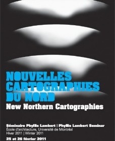
Récemment, la fin de la guerre froide et le réalignement subséquent de l’équilibre des pouvoirs entre les puissances ont redéfini de nouveau la carte des régions arctiques, lesquelles soulèvent désormais un intérêt à la fois passionnel et stratégique. En même temps, les changements climatiques extraordinaires relancent le débat sur le développement durable et l’exploitation raisonnable des ressources. C’est ce sujet qui est proposé cette année par le séminaire Phyllis Lambert sous la forme d’un colloque qui se tiendra à l’École d’architecture de l’Université de Montréal les 25 et 26 février 2011. Architectes, artistes, archéologues et climatologues sont invités à participer.
English
“Il y a tant de nords dans ce Nord” (There are many norths in this North). Thus wrote the great Quebecois geographer Louis?Edmond Hamelin in Nordicité canadienne (1975). The remark summarized his brilliant reconfiguration of the Canadian North. Hamelin graded ten geographical and human factors ? latitude, summer heat, annual cold, types of ice, precipitation, vegetation cover, land or sea accessibility, air service, population, economic activity ? on the scale of 0?100 (100 representing extreme nordicity). The sum of the ten elements indicated the VAPO (Valeur polaires, polar values) of a region, with the North Pole reaching a VAPO of 1000. On this basis, Hamelin proposed a redefinition of the Canadian North in Extreme North, Far North, Middle North, and Near North. Thus an incredibly vast and vaguely defined geographical entity was reduced to a series of manageable regions open to transformation. Hamelin also identified and defined processes of “nordification” and “denordification”. Major technological investments could diminish drastically the degree of nordicity of a region, while a locality could undergo a process of brutal nordification when mining or other industrial activities were suspended. Hamelin’s method was inspired by the criteria applied by Russian engineers in order to better identify the regional, local, or punctual realities of the Siberian continent. In both cases, the Nordicity Index, indicating the degree of the investment of the government in a region assumed a charged political connotation and heralded the idea of a “voluntary geography”, or the radical transformation of once uninhabitable territories thanks to the technological harnessing of a previously forbidding “Nature”.
The works of Hamelin and of Russian scientists appeared at the end of more than three decades of powerful efforts of militarization and modernization of the Arctic regions. The awareness of the strategic importance of the North began during WWII and reinforced throughout the Cold War, stimulated the deployment of massive resources for the building of vast transportation networks, spectacular military installations, and ambitious permanent settlement. This vigorous activity did not escape the attention of intellectuals, architects and artists that, during the Sixties and the Seventies, produced a plethora of provoking proposals or poignant commentaries addressing the massive changes taking place in the once remote and romantic North.
During the last two decades, the end of the Cold War and subsequent realignment of the balance of powers, together with massive climate changes, have in fact redefined, once again, the map of the Arctic region and rekindled a passionate interest in the North. The proposal is that the 2011 Phyllis Lambert Seminar will take the form of a colloquium, to be held at the École d’architecture, Université de Montréal, February 25?26, 2011. Architects, artists, film makers, geographers, and climatologists will be asked to participate.


